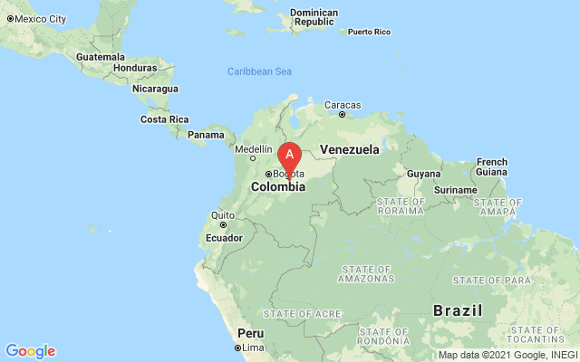
colombia flag of Colombia
Print this pages
Email to a friend Add to Favorites
 
 
Welcome, Guest. Please login or register here


map of Colombia
Introduction: COLOMBIA
Colombia was one of the three countries that emerged from the collapse of Gran Colombia in 1830 (the others being Ecuador and Venezuela). A 40-year insurgent campaign to overthrow the Colombian Government escalated during the 1990s, undergirded in part by funds from the drug trade. Although the violence is deadly and large swaths of the countryside are under guerrilla influence, the movement lacks the military strength or popular support necessary to overthrow the government. An anti-insurgent army of paramilitaries has grown to be several thousand strong in recent years, challenging the insurgents for control of territory and the drug trade, and also the government's ability to exert its dominion over rural areas. While Bogota steps up efforts to reassert government control throughout the country, neighboring countries worry about the violence spilling over their borders.
GEOGRAPHY
Country name: conventional long form: Republic of Colombia
conventional short form: Colombia
local long form: Republica de Colombia
local short form: Colombia
Capital: Bogota
Location: Northern South America, bordering the Caribbean Sea, between Panama and Venezuela, and bordering the North Pacific Ocean, between Ecuador and Panama
Geographic Coordinates: 4 00 N, 72 00 W
Area: total: 1,138,910 sq km
land: 1,038,700 sq km
water: 100,210 sq km
note: includes Isla de Malpelo, Roncador Cay, Serrana Bank, and Serranilla Bank
Area Comparative: slightly less than three times the size of Montana
Land Boundaries: total: 6,004 km
border countries: Brazil 1,643 km, Ecuador 590 km, Panama 225 km, Peru 1,496 km (est.), Venezuela 2,050 km
Coastline: 3,208 km (Caribbean Sea 1,760 km, North Pacific Ocean 1,448 km)
Maritime Claims: territorial sea: 12 nm
exclusive economic zone: 200 nm
continental shelf: 200-m depth or to the depth of exploitation
Climate: tropical along coast and eastern plains; cooler in highlands
Terrain: flat coastal lowlands, central highlands, high Andes Mountains, eastern lowland plains
Elavation Extremes: lowest point: Pacific Ocean 0 m
highest point: Pico Cristobal Colon 5,775 m
note: nearby Pico Simon Bolivar also has the same elevation
Natural Resources: petroleum, natural gas, coal, iron ore, nickel, gold, copper, emeralds, hydropower
GOVERNEMENT
Governement Type: republic; executive branch dominates government structure
Administratives Divisions: 32 departments (departamentos, singular - departamento) and 1 capital district* (distrito capital); Amazonas, Antioquia, Arauca, Atlantico, Distrito Capital de Bogota*, Bolivar, Boyaca, Caldas, Caqueta, Casanare, Cauca, Cesar, Choco, Cordoba, Cundinamarca, Guainia, Guaviare, Huila, La Guajira, Magdalena, Meta, Narino, Norte de Santander, Putumayo, Quindio, Risaralda, San Andres y Providencia, Santander, Sucre, Tolima, Valle del Cauca, Vaupes, Vichada
Independence 20 July 1810 (from Spain)
National Holiday: Independence Day, 20 July (1810)
Constitution: 5 July 1991
Legal System; based on Spanish law; a new criminal code modeled after US procedures was enacted into law in 2004; judicial review of executive and legislative acts; accepts compulsory ICJ jurisdiction, with reservations
Suffrage 18 years of age; universal
Executive Branch: chief of state: President Alvaro URIBE Velez (since 7 August 2002); Vice President Francisco SANTOS (since 7 August 2002); note - the president is both the chief of state and head of government
head of government: President Alvaro URIBE Velez (since 7 August 2002); Vice President Francisco SANTOS (since 7 August 2002); note - the president is both the chief of state and head of government
cabinet: Cabinet consists of a coalition of the two dominant parties - the PL and PSC - and independents
elections: president and vice president elected by popular vote for a four-year term; election last held 26 May 2002 (next to be held May 2006)
election results: President Alvaro URIBE Velez received 53% of the vote; Vice President Francisco SANTOS was elected on the same ticket
Legislative Branch: bicameral Congress or Congreso consists of the Senate or Senado (102 seats; members are elected by popular vote to serve four-year terms) and the House of Representatives or Camara de Representantes (166 seats; members are elected by popular vote to serve four-year terms)
elections: Senate - last held 10 March 2002 (next to be held March 2006); House of Representatives - last held 10 March 2002 (next to be held March 2006)
election results: Senate - percent of vote by party - NA%; seats by party - PL 28, PSC 13, independents and smaller parties (many aligned with conservatives) 61; House of Representatives - percent of vote by party - NA%; seats by party - PL 54, PSC 21, independents and other parties 91
Judicial Branch: four roughly coequal, supreme judicial organs; Supreme Court of Justice or Corte Suprema de Justicia (highest court of criminal law; judges are selected by their peers from the nominees of the Superior Judicial Council for eight-year terms); Council of State (highest court of administrative law; judges are selected from the nominees of the Superior Judicial Council for eight-year terms); Constitutional Court (guards integrity and supremacy of the constitution; rules on constitutionality of laws, amendments to the constitution, and international treaties); Superior Judicial Council (administers and disciplines the civilian judiciary; resolves jurisdictional conflicts arising between other courts; members are elected by three sister courts and Congress for eight-year terms)
Political parties and Leaders: Colombian Communist Party or PCC [Jaime CAICEDO]; Conservative Party or PSC [Carlos HOLGUIN Sardi]; Democratic Pole or PDI [Samuel MORENO Rojas]; Liberal Party or PL [Juan Fernando CRISTO]
note: Colombia has about 60 formally recognized political parties, most of which do not have a presence in either house of Congress
PEOPLE
Population: 42,954,279 (July 2005 est.)
Age structure: 0-14 years: 30.7% (male 6,670,950/female 6,516,371)
15-64 years: 64.2% (male 13,424,433/female 14,142,825)
65 years and over: 5.1% (male 968,127/female 1,231,573) (2005 est.)
Median age: total: 26.04 years
male: 25.14 years
female: 26.93 years (2005 est.)
Nationality: noun: Colombian(s)
adjective: Colombian
Ethnic groups: mestizo 58%, white 20%, mulatto 14%, black 4%, mixed black-Amerindian 3%, Amerindian 1%
Religions: Roman Catholic 90%, other 10%
Languages: Spanish
COMUNICATIONS
Telephones - main lines in use: 8,768,100 (2003)
Telephones - mobile cellular: 6,186,200 (2003)
Telephone system: general assessment: modern system in many respects
domestic: nationwide microwave radio relay system; domestic satellite system with 41 earth stations; fiber-optic network linking 50 cities
international: country code - 57; satellite earth stations - 6 Intelsat, 1 Inmarsat; 3 fully digitalized international switching centers; 8 submarine cables
Radio broadcast stations: AM 454, FM 34, shortwave 27 (1999)
Television broadcast stations: 60 (includes seven low-power stations) (1997)
Internet country code: .co
Internet hosts: 115,158 (2003)
Internet users: 2,732,200 (2003)
TRANSPORT
Railways: total: 3,304 km
standard gauge: 150 km 1.435-m gauge
narrow gauge: 3,154 km 0.914-m gauge (2003)
Highways: total: 112,998 km
paved: 26,000 km
unpaved: 84,000 km (2000)
Waterways: 9,187 km (2004)
Pipelines: gas 4,360 km; oil 6,134 km; refined products 3,140 km (2004)
Ports and harbors: Bahia de Portete, Barranquilla, Buenaventura, Cartagena, Leticia, Puerto Bolivar, San Andres, Santa Marta, Tumaco, Turbo
Merchant marine: total: 15 ships (1,000 GRT or over) 35,427 GRT/46,301 DWT
by type: bulk carrier 1, cargo 11, liquefied gas 1, petroleum tanker 2
registered in other countries: 7 (2005)
Airports: 980 (2004 est.)
Airports - with paved runways: total: 101
over 3,047 m: 2
2,438 to 3,047 m: 9
1,524 to 2,437 m: 39
914 to 1,523 m: 39
under 914 m: 12 (2004 est.)
Airports - with unpaved runways: total: 879
2,438 to 3,047 m: 1
1,524 to 2,437 m: 34
914 to 1,523 m: 272
under 914 m: 572 (2004 est.)
Heliports: 1 (2004 est.)
 
 
Copyright © 1blueplanet.com